
Trail Guide · ~20 min from Pisgah Base Camp
Bennett Gap
One of Pisgah's classic technical descents, ridden as a roughly 10-mile loop with a gravel climb, real ridgetop views, and a rocky, advanced ripping descent back down.
Drive Time
~20 min
from the house
Loop Distance
~10 mi
varies by route
Climbing
~2,000 ft
mostly gravel up front
Difficulty
Advanced
black diamond, technical
What to Expect
Earn the climb, respect the descent
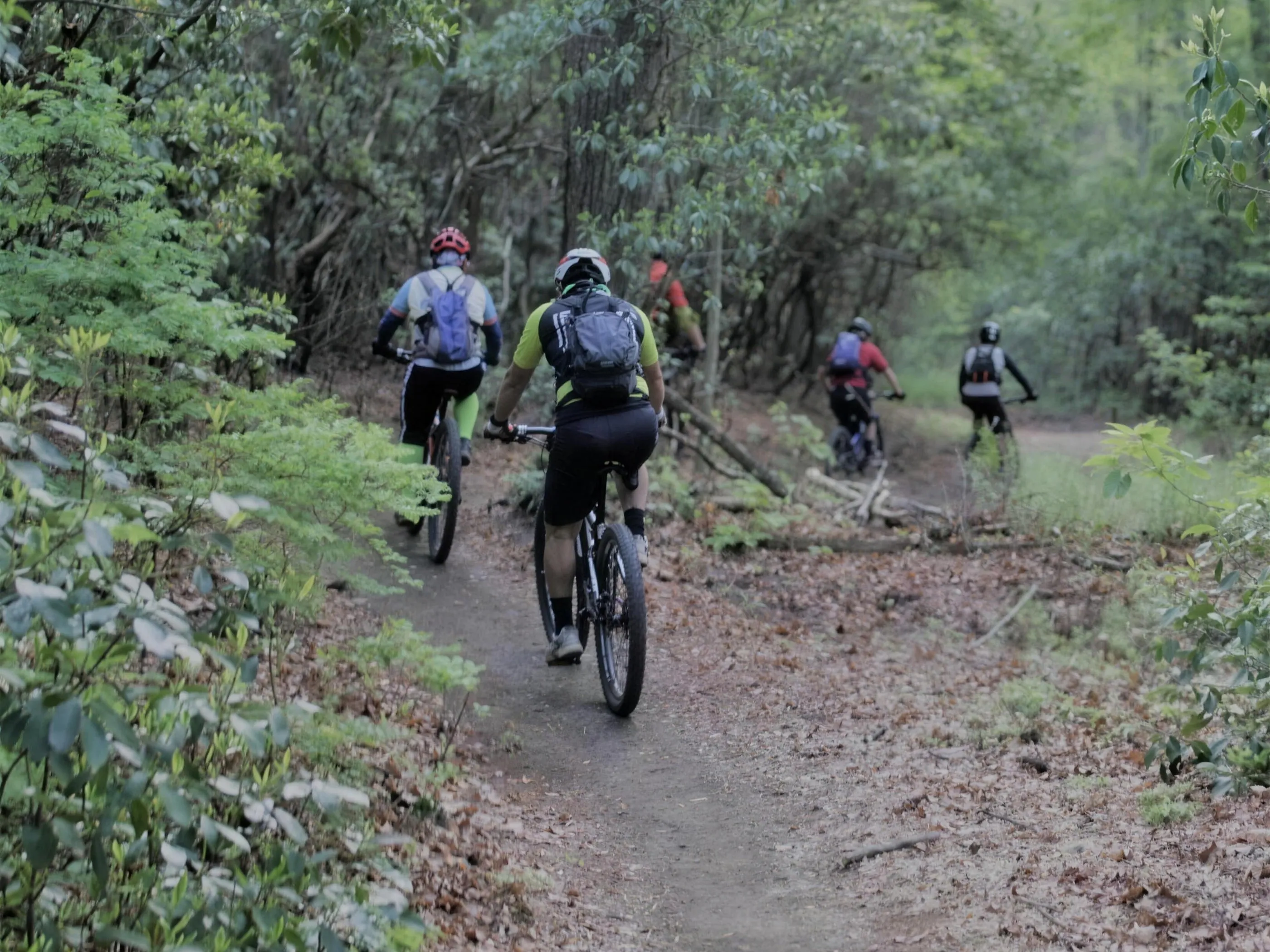
Bennett Gap is one of the rides people come to Pisgah for, and one of the reasons Pisgah has the reputation it does. Most riders do it as a loop of about 10 miles, give or take depending on where you start and which connectors you link. The usual shape is a long gravel climb up front, a stretch of singletrack across the top, then the Bennett Gap descent to finish. The exact mileage and climbing change with your route, so plan around two to three hours of moving time and more if you stop for the views.
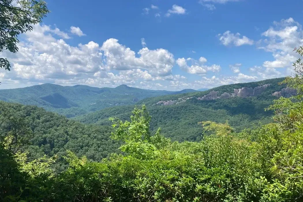
The climb is the easy part to understand. It is mostly forest road, steady and long, the kind of grind that gets you to the top with your legs warm. The reward up high is something Pisgah rarely gives you: open ridgetop views. Most bike-legal trails here are buried in tree cover, but Bennett Gap runs along an exposed ridge with looks at Looking Glass Rock, Cedar Rock, the Davidson River valley, and Black Mountain. Take a minute up there. You earned it and you do not get it often.
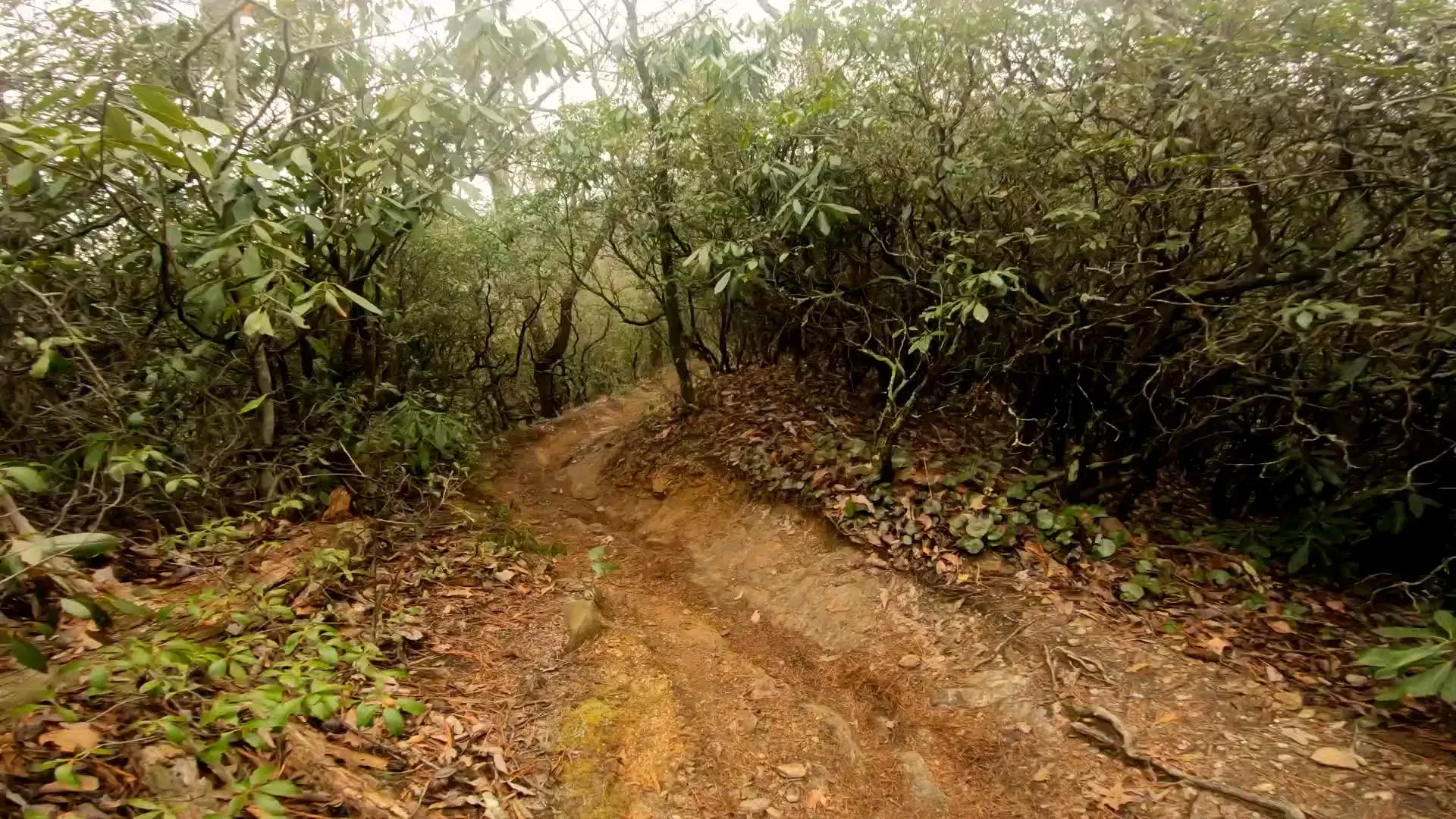
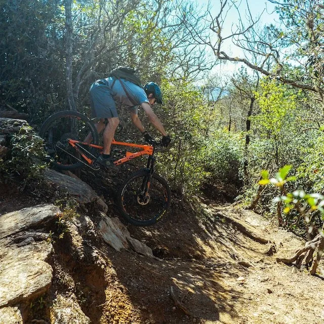
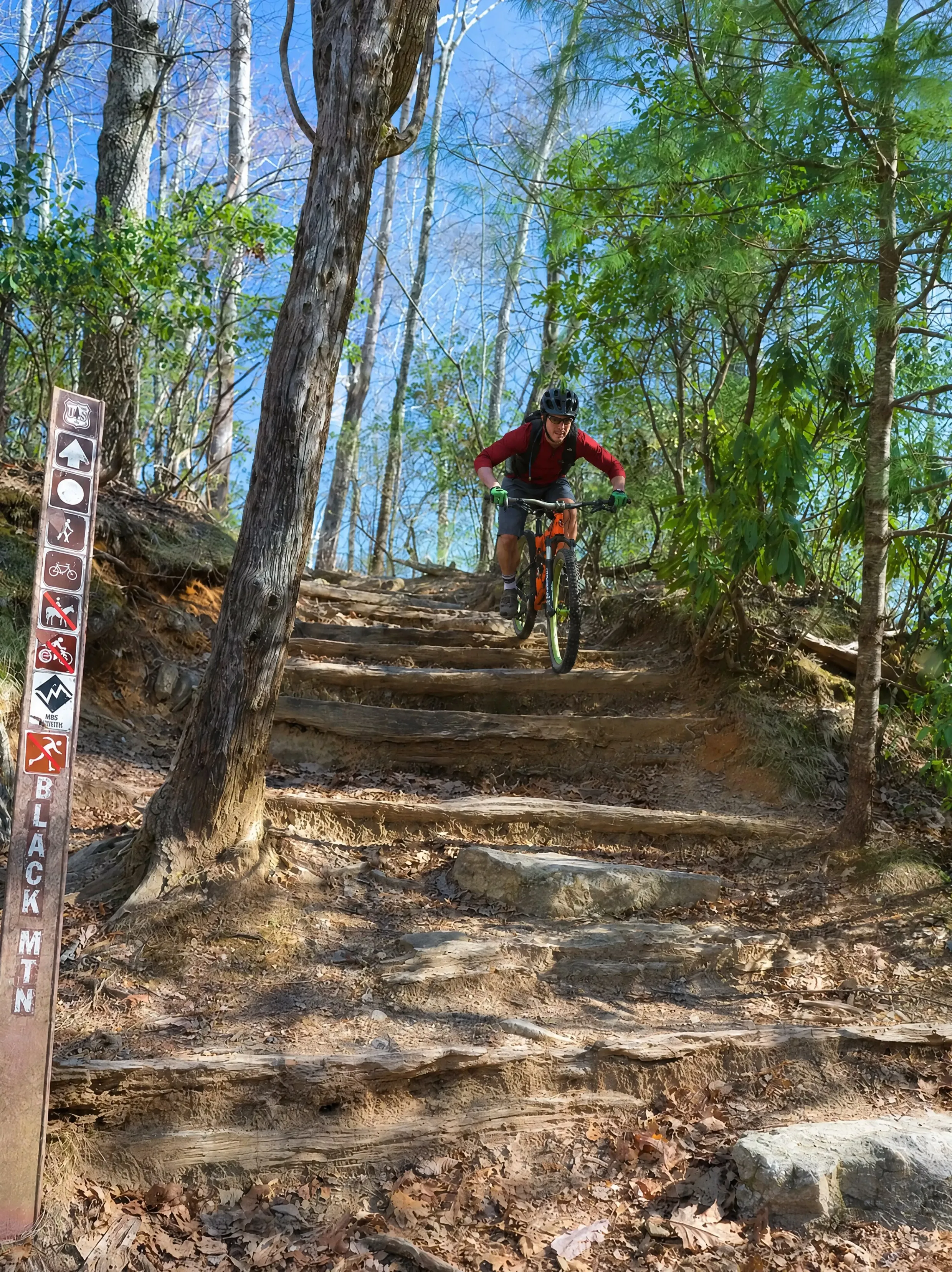
Then the trail turns down, and this is where Bennett Gap earns its name among riders. The descent is rocky, steep, and technical, with chunky switchbacks, exposed sections with real drop-offs on the downhill side, and one infamous rock feature locals call the Devil's Staircase that most people walk. This is advanced terrain. The Forest Service rates the trail moderate as a footpath, but in mountain-bike terms it rides as a black diamond, and Pisgah has a way of riding harder than its rating. Full-suspension and solid technical skills are the right tools here, and even strong riders hike-a-bike through the worst of it.
If this is your first ride in the area, this is not the one to start on. Warm up at DuPont first to dial in your legs and your line choice, then come back for Bennett Gap when you know what Pisgah rock feels like. When you are ready, it is one of the best descents in the region, fast and rough and genuinely fun once the hardest moves are behind you.
The Ride
How the loop breaks down
The Climb
Gravel, steadyMost versions start with a long forest-road climb, often up Clawhammer Road and onto Buckwheat Knob, to reach the high singletrack. It is a grind, not technical, and it is how you buy the descent. Bring water and pace it.
The Ridge
The viewsUp top the trail runs along an open ridge with rare Pisgah views: Looking Glass Rock, Cedar Rock, the Davidson valley, and Black Mountain. There are a couple of viewpoints close together near the high point. Stop and take them in, because tree cover hides most Pisgah trails.
The Descent
Rocky, advancedBennett Gap drops fast and rough: rock gardens, tight chunky switchbacks, exposed sections with drop-offs, and the notorious Devil's Staircase, which most riders walk. Advanced skills and full-suspension strongly recommended. Ride within your limits, the consequences here are real.
Why We Love It
A real Pisgah ride, 20 minutes away
Bennett Gap is the kind of ride that reminds you why Pisgah has the name it does. It is not manicured flow. It is rocky, demanding, old-school mountain biking with a payoff of views and a descent you will be talking about over post-ride beers. For the rider who came here to test themselves on the East's most rugged trails, this is exactly the day they were hoping for.
And it is close. You can be at the trailhead in about 20 minutes from the house, ride a big loop, and be back washing the bike and climbing into the hot tub by evening. That is the whole point of a basecamp. Hard ride, short drive, and a place set up to clean the gear and recover when you roll back in.
Backstory
Why Pisgah rides the way it does
Pisgah National Forest is a National Geographic top-ten mountain-bike destination, and trails like Bennett Gap are why. The riding here grew up rugged: long forest-road climbs to reach ridgetop singletrack, minimal trail grooming, and rock and roots left mostly as the mountain made them. There are no shortcuts to the good stuff, which is part of the appeal.
Bennett Gap in particular has long been a proving ground. It shows up in the Pisgah Stage Race and in countless classic loop routes linking Avery Creek, Buckwheat, Black Mountain, and Coontree. Riders have advocated for years to keep it open and rideable. That history is worth respecting on the trail: yield to hikers, stay on the line, and ride like you want it open for the next person too.
Know Before You Go
Ride prepared, this is Pisgah
- Confirm bike access first. Bennett Gap has carried seasonal bike rules in the past. Check the current Pisgah Ranger District rules before you load the bikes so you ride it on a legal day.
- Check road and trail status. Avery Creek Road (FS 477) to the trailhead took Helene damage and access has shifted during recovery. Verify the road is open to the Bennett Gap trailhead before you drive out.
- Bring the right bike. Full-suspension and advanced technical skills are strongly recommended. This is not a beginner or intermediate trail.
- Expect hike-a-bike. Even strong riders walk sections, including the Devil's Staircase. That is normal here, not a failure.
- Warm up at DuPont first. If it is your first ride in the area, ride DuPont to dial in before taking on Pisgah rock.
- Parking is tight. The Bennett Gap trailhead lot holds only a few cars. Have a backup plan or start early.
- Carry the essentials. Cell service is spotty to none. Bring water, tools, a tube, and download an offline map before you leave the house.
Safety First
Real consequences on this trail
- The descent has exposed sections with steep drop-offs on the downhill side. A mistake here can be serious. Ride within your skill and walk what you are not sure of.
- Pisgah rides harder than its rating. Treat a "moderate" Forest Service label with caution. In bike terms this is advanced.
- Loose rock, wet roots, and slick rock are common, especially after rain. Conditions change fast.
- Yield to hikers and other trail users. This is a shared, multi-use trail.
- Spotty cell service means self-rescue is the default. Ride with a partner when you can, and tell someone your plan.
Directions
From Pisgah Base Camp to the trailhead
The Bennett Gap trailhead sits off FS 477 (Avery Creek Road), about 2.5 miles south of US-276 in the Pisgah Ranger District. Parking is a small lot for a few cars, and the trail begins at a nearby gate. Many riders shuttle or set up a loop rather than backtrack.
- 1 From the house, head to the US-276 corridor and into Pisgah National Forest.
- 2 Take US-276 north past the ranger station toward Avery Creek Road (FS 477).
- 3 Turn onto FS 477 and follow it about 2.5 miles to the Bennett Gap trailhead parking.
- 4 If the small lot is full, have a backup plan rather than blocking the gate or road.
Avery Creek Road and Pisgah trails can close for weather, repairs, and ongoing Helene recovery, and Bennett Gap may carry seasonal bike rules. Confirm current road status and bike access before you go.
Keep Exploring
Other rides and stops
You Already Know the Trip You Want
An early start. A big day outside. Then a hot shower and a quiet night when you get back.
That's the trip. You just need the right place to do it from.
We'll help you sort out the plan before you get here. You bring the bikes, boots, rods, and the dog.