Trail Guide · ~55 min from Pisgah Base Camp
Black Balsam Knob
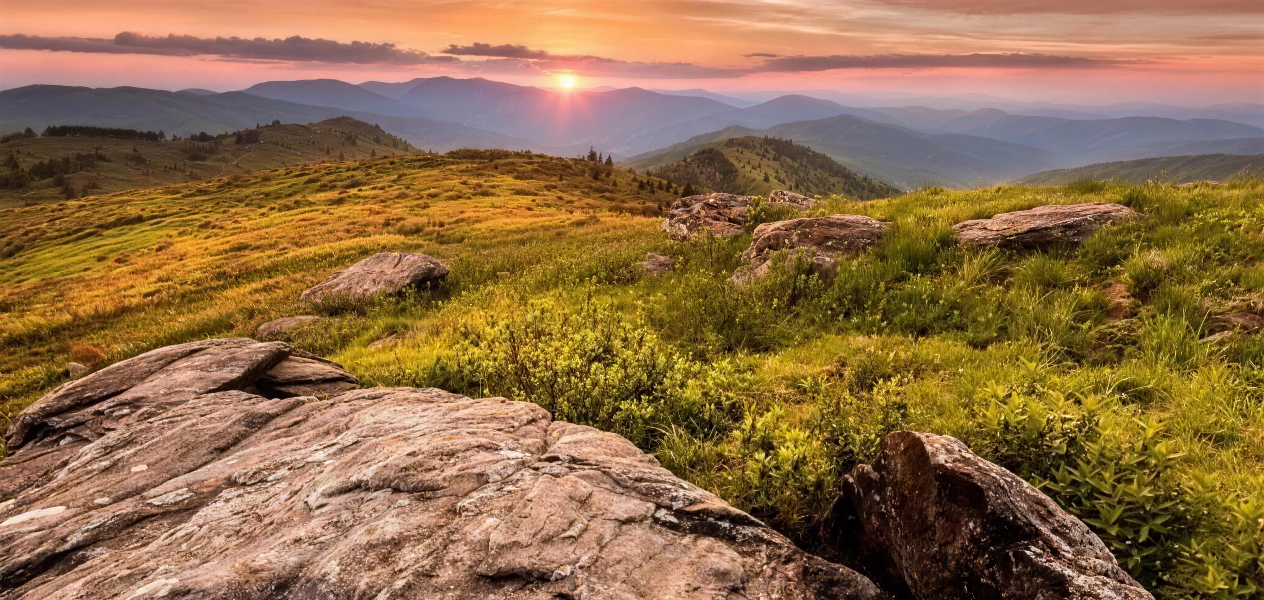
A treeless 6,214-foot summit with 360-degree views, reached by a short walk off the Blue Ridge Parkway, about 55 minutes from the house.
Drive Time
~55 min
from the house
Summit Hike
1.5 mi
round trip
Elevation Gain
~400 ft
to a 6,214 ft summit
Difficulty
Easy to Moderate
short but fully exposed
What to Expect
Big views for a short walk
Black Balsam Knob is one of the rare places where a short, easy walk drops you onto a summit that feels like another part of the world. At 6,214 feet it is one of the highest points in North Carolina, and the top is a treeless grassy bald with unbroken 360-degree views, ridge after ridge stretching more than 40 miles in every direction. People compare it to the Scottish Highlands or New England, not the American South. It earns the comparison.
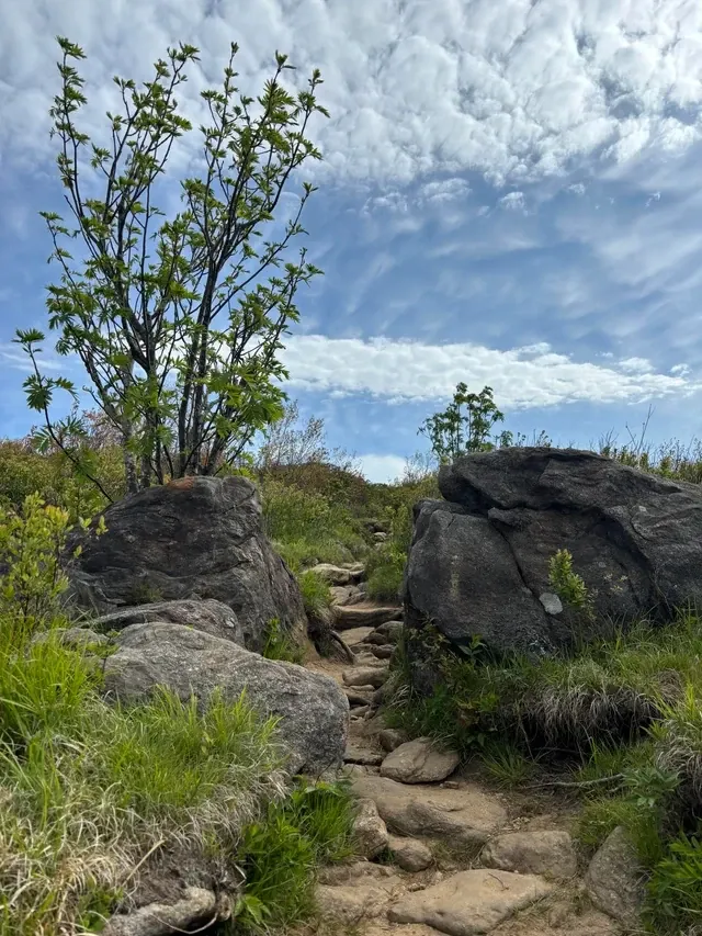
The classic hike is the summit out-and-back, about 1.5 miles round trip with roughly 400 feet of gain. The trail is part of the Art Loeb Trail and starts in a fragrant grove of balsam fir, then breaks out of the trees after about half a mile into open meadow. From there it climbs over a lower rise and up to the rocky top, where a plaque marks the high point of the Art Loeb Trail. The view is immediate and total. There is nothing blocking it.
If you want more, the same trailhead opens longer days. A popular 5-mile loop links Black Balsam with neighboring Tennent Mountain and returns along the Ivestor Gap Trail, crossing nearly three miles of open bald without dropping back into forest. Strong hikers can extend further into the Shining Rock Wilderness or combine the day with Devil's Courthouse and Sam Knob nearby. The beauty here is that you choose the length and the views stay big the whole time.
The trade-off for all that openness is exposure. There is almost no shade, the weather shifts fast at this elevation, and what feels mild at the house can be cold, windy, and wet up top. That is not a reason to skip it. It is a reason to pack layers and a rain shell, start early, and keep an eye on the sky.
The Hikes
Pick your distance
Summit Out-and-Back
Easiest · ~1.5 miThe classic. About 1.5 miles round trip and 400 feet of gain to the 6,214-foot summit. Through balsam fir, out onto the bald, up to the plaque and the full panorama. Doable by most fit hikers and kids, but fully exposed once you leave the trees.
Black Balsam + Tennent Loop
Moderate · ~5 miThe recommended bigger day. Links Black Balsam and Tennent Mountain, both over 6,000 feet, and returns on the Ivestor Gap Trail. Nearly three miles of continuous open bald with the views changing as you move along the ridge.
Extended & Wilderness
Strenuous · longerFor a full mountain day, continue past Tennent into the Shining Rock Wilderness, or pair the summit with nearby Devil's Courthouse and Sam Knob. Bigger mileage, more solitude, and real backcountry. No campfires in the wilderness, and bring everything you need.
Why We Love It
The biggest view for the least effort
There are harder hikes around here with smaller payoffs. Black Balsam is the opposite. For about a mile and a half of walking, you get one of the best summit views in the entire East, the kind of place where conversations go quiet and nobody wants to leave. It is the easy call when you want the group to feel like they really got somewhere without making it a brutal day.
It is also a place worth timing well. Late August brings wild blueberries you can pick by the handful. Late September puts it among the earliest fall color in western North Carolina, weeks ahead of the valleys. And sunrise or sunset up here, with the light running across the balds, is something people plan whole trips around. Bring a layer, bring a camera, and give yourself time to just sit up top.
Backstory
Why the mountain is bald
Black Balsam belongs to a rare landscape called an Appalachian grassy bald, a treeless summit meadow in mountains where you would expect forest. Why some Southern Appalachian summits are bald and others are not is still one of ecology's unsolved puzzles, with theories ranging from ancient grazing animals to Native American burning to old logging and fire. At Black Balsam, historical clear-cutting and fire helped open and shape the sweeping meadows you walk today.
The trail itself carries a story. It is named for Arthur Loeb, a Philadelphia industrialist who came to Brevard to run the Ecusta Paper Mill and took up hiking after a heart attack in his 40s. He spent his weekends piecing together the trail connections that link the Davidson River near Brevard to the high country up here. He died in 1968 before the route was finished, and the Carolina Mountain Club and Forest Service carried his vision forward. The Art Loeb Trail opened in his honor in 1979, and the plaque at the summit marks its highest point.
Know Before You Go
High, exposed, and worth doing right
- Go early. The roadside parking on Black Balsam Road fills by mid-morning on summer and fall weekends. Early arrival gets you a spot and gets you off the summit before afternoon storms.
- Dress for the top, not the bottom. It can be 20 degrees cooler than the valleys, with wind. Bring layers and a rain shell even on a warm day.
- There is no shade. Most of the route is fully exposed. Bring sunscreen and a hat.
- Carry your own water. There is no water at the trailhead or summit. Bring at least 2 liters per person.
- Check Parkway status first. The Parkway closes for ice, snow, and storms, especially in winter. When it is closed, the Flat Laurel Creek route off NC-215 is the alternate way in.
- Best windows. Wild blueberries peak in late August. Fall color peaks up high in late September, earlier than the valleys.
- Dogs welcome. Leashed dogs are fine. Bring water for them too, since there is none up top.
- Stay on the trail. The balds are slow to recover from off-trail traffic. Walk the established path and pack out everything.
Safety First
Exposure is the real risk
- Get off the open summit by early afternoon in summer. Thunderstorms build fast at this elevation, and you do not want to be the high point on a treeless bald during lightning.
- Weather can turn cold, wet, and windy with little warning. People underdress for 6,000 feet and regret it. Layers and a rain shell are not optional.
- The footing is rocky and can be muddy. Trekking poles help on the descent.
- Cell service is spotty to none. Tell someone your plan and download an offline map before you go.
- This is black bear country, and there is no water up top. Carry water and pack out all food and trash.
Directions
From Pisgah Base Camp to the trailhead
Black Balsam sits off the Blue Ridge Parkway at Milepost 420.2, just south of Graveyard Fields and north of Devil's Courthouse. From the Parkway, turn onto Black Balsam Road (FS 816) and follow it to the roadside parking. The Art Loeb Trail to the summit starts along the road.
- 1 From the house, head up the US-276 corridor to the Blue Ridge Parkway.
- 2 Turn south on the Parkway and drive past Graveyard Fields toward Milepost 420.2.
- 3 Turn onto Black Balsam Road (FS 816) and follow it about 0.7 miles to the roadside parking.
- 4 If the parking is full, use the larger lot at the end of the road by the Ivestor Gap and Sam Knob trailheads, or come back later.
The Blue Ridge Parkway closes in sections for ice, snow, storms, and ongoing repairs. Check current Parkway status before you go, and use the Flat Laurel Creek route off NC-215 if the Parkway is closed.
Keep Exploring
Other places guests love
You Already Know the Trip You Want
An early start. A big day outside. Then a hot shower and a quiet night when you get back.
That's the trip. You just need the right place to do it from.
We'll help you sort out the plan before you get here. You bring the bikes, boots, rods, and the dog.